flat72.jpg)

•
•
•
• Demographics
•
•
•
•
•
•
• Foreign Trade
• Privatization
•
•
•
•
•
•
• Caspian Basin Issues
•
•
• Oil & Gas Agreements
•
•
• Agriculture
• Industry
•
•
• Travel
•
•
![]()

Geography
and Climate
The Republic
of Azerbaijan is an independent country located in the southeastern Caucasus region of western
Asia. Geographic grid coordinates: 40 30 N, 47 30 E Azerbaijan has a total area of 33,400 square miles (86,600
km) and shares borders with the Russian Federation on the north (284 km),
Georgia on the northwest (322 km), Armenia on the west, southwest (221 km), Iran on
the south (432 km) and the Caspian Sea on the east (800 km est).
The region of Iran, south of the Araz River, which marks the border, is
also known as Azerbaijan. People on both sides of this border speak
the same Turkic language, share the religion of Islam and once shared a
common history, until the Russian annexation of Azerbaijan north of the
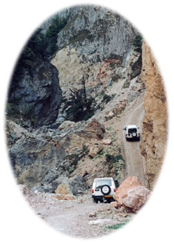
Araz River as a result of the Treaty of Turkmanchai, February 10, 1828. Mountainous road to Guba
Azerbaijan was
part of the Russian Empire from the early 19th century to 1918, briefly
an independent republic from 1918 to 1920, and a part of the Soviet Union
from 1922 to 1991. On August 30, 1991, it declared its independence
from the Soviet Union. Independence was officially restored on October
18, 1991. The capital and largest city of Azerbaijan is Baku.
The republic includes two administrative divisions with special status.
These are the autonomous Republic of Nakhchivan, which is separated from
Azerbaijan proper by southern Armenia, and the autonomous district
of Nagorno-Karabakh (Qarabag), which is occupied mainly by Armenians and
was seized by Armenian military forces in 1992.
THE LAND
Terrain Features
Mountains cover
half of Azerbaijan and three of the dominant relief features converge
within the country. These features are the Greater Caucasus Mountains
in the northeast, the Lesser Caucasus in the southwest and the Kura River
depression in between. In the extreme southeast, the Araz River Valley
extends between the Zangazur and Dilagarez ranges. The highest elevation,
14715 feet (4485 meters) on Mount Bazardyuzyu, is in the Greater Caucasus,
on the border with Russia. The higher mountains abound in glaciers
and rapids, while the mid-elevation ranges are separated by deep chasms.
The Greater Caucasus' descend abruptly in the east and shrink to low, arid
hills. To the north of the Greater Caucasus, in eastern Azerbaijan, extends
the sloping Gusar Plateau. The lowest region in the country, the
Kura depression in the southeast, is divided into two parts. Its
western area and northern rim are marked by hills, ridges and valleys.
Along the foot hills of the subtropical southeastern coast viewers can observe tea plantations, citrus groves, numerous mud volcanoes, and minerals springs, along the gulches and ravines of Gobustan mountain to the west of Baku.
The central and eastern areas of the depression consist of alluvial plains
and the low delta of the Kura River along the coast. Much of this
low-lying area is threatened by rising levels of the Caspian Sea.
The 500-mile (800 km) long Caspian cost line of Azerbaijan is largely consistent.
The largest land projections are the Absheron peninsula, the Sara Peninsula
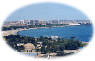
and the Kura sand bar. Baku Harbour
Rivers and Lakes
Of the more than
1000 rivers in Azerbaijan, only 21 are longer than 60 miles (97 km).
The Kura, the largest river in the Transcaucasia, flows through Azerbaijan from
northwest to southeast and empties into the Caspian Sea. The Caspian is the source of the world's largest population of caviar-producing sturgeon. The main
tributary of the Kura is the Araz River, also known as the Araxes. Most of Azerbaijan's rivers
are in the Kura basin. In the plains the rivers are used for crop
irrigation. The large Mingachevir Hydroelectric Power Plant and the
Migachevir Reservoir, 234 square miles (605 square km) in area, are located
on the Kura. Most of the 250 lakes in Azerbaijan are small.
Lake Hajigabul is the largest, with an area of 6 square miles (16 square
km), and Lake Boyukshor with an area of 4 square miles (10 square km) is
next largest.
Climate
Azerbaijan has
a unique diversity of climates, which includes nine climate zones out of thirteen
existing zones. These range from arid sub-tropical and humid sub-tropical
to a mountainous tundra climate (cold, dry). The mean annual temperature
ranges from 59F (15C) in low-lying
areas to 32F (0C) in the mountains. The mean temperatures in July
are 70F (26C) in low-lying areas and 41F (5C) in the highlands.
Summers are dry in the lowlands. The distribution of annual rainfall
is highly uneven, with 8 to 12 inches (200-300mm) in coastal areas and
in the southeastern lowlands, 12 to 35 inches (300-900 mm),
in the foothills of the medium-elevation mountains, 39 to 51 inches (1000- 1300 mm) in the southern slopes of the Great Caucasus range and 47 to
55 inches (1200-1400) in the southern Lankaran lowland. In the lowland,
precipitation decreases in the winter, and in the mountains and hills,
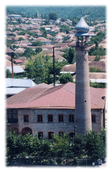
it decreases primarily from April to September. The city of Sheki FACT BOX
Capital: Baku
Elevation:
Principal language:
Azerbaijani
Currency unit:
1 Manat = 100 gapiks
|